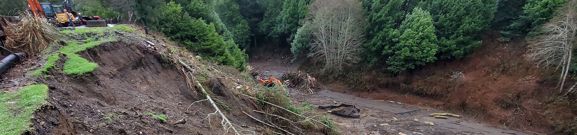
Gain a solid understanding of your site’s potential hazards, like landslide and erosion risks.
Understanding your site’s seismic activity and earthquake risks helps you build a structure that will withstand them.
Gain a better understanding of your site’s subsurface condition and how it affects your project.
Gain insight on the groundwater movement and its impact on your site.
Accurately understand the quality and extractable quantity of aggregates and materials in your quarry site, while maintaining quarry slope stability.
Without local geological understanding, your project’s off to a muddy start. You need experts who know the Pacific Northwest and the unique challenges it brings to every project.
We use core data, aerial photography, and specialized geophysical tactics, combined with state-of-the-art soil and rock evaluation software, to understand your geologic hazards and earthquake risks. Our own materials testing laboratory ensures your results are accurate and reliable. And our team isn’t just knowledgeable; they are licensed experts in Oregon State’s geology.
Go beyond surface-level data on your jobsite.
Send us your project’s documents and details.
We’ll scope the project and give you a comprehensive proposal.
With the proposal signed, we’ll investigate your site and the project challenges you’re facing.
We’ll share our preliminary findings and recommendations with your team. Then, we’ll meet with you to discuss them.
You’ll receive a final report that you can use to inform your design decisions and build safely.
High-stakes construction requires highly skilled geologic expertise. Luckily, we’ve got it.
Our construction planning and design services are trusted by public agencies, architects, developers, homeowners, and businesses across Oregon.
Professional and quick to respond and schedule appointments. Ben was kind and most helpful. He went our of his way to help us.
Amanda B.
Great people that you can trust!
Shelly G.
Excellent work ethic. On time with reports. Friendly staff, I would pick Galli Group as the number one engineering company in this area. Don't waste your time with others. Book an appointment now and get your project going ahead quickly and professionally. Much Aloha to the staff and owner.
Michael C.
Very helpful, professional and friendly.
Russell H.
Great service and a very quick response to our needs!
Rene P.
Get tailored, site-specific engineering geology and geophysics from experts on the Pacific Northwest.